
South Beach in letters: a run that spells MIA
South Beach in letters: a run that spells MIA: 5.4 mi (8.8 km) out and back from 14th Street. The line draws MIA on the map: upload the GPX and your Strava map shows it.
Draw it on your watch
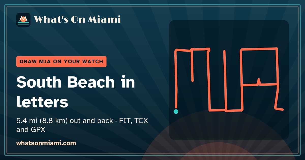
Your watch draws MIA over Miami. Post the map.
Garmin Connect → Training & Planning → Courses → Import, or copy the .fit into the watch's GARMIN/NewFiles folder. Strava, Coros and Apple Watch: use the GPX. The watch shows 22 turns, left or right, as you reach them.
Teal dot: the start. Teal diamonds: run clubs that meet close by.
| Distance | 5.4 mi (8.8 km) |
|---|---|
| Type | Out and back |
| Start | 14th Street |
| Surface | Not stated in our sources; city streets and sidewalks on OpenStreetMap. |
| Shade | Not stated in our sources. |
| Water and restrooms | Not stated in our sources. |
| Best time | Not stated in our sources. |
| Watch out for | An art route, not an established running route; check traffic and crossings. It turns at many junctions, so follow the GPX on a watch or phone. We haven't run it. |
The GPX loads into Strava, Garmin Connect, Komoot and most watch apps as a route to follow. The line follows OpenStreetMap's paths; check closures and construction on the day.
Run this with others: join What's On Miami Runs on Strava for group runs, routes and race weeks.
Run clubs close by
- Baptist Health South Beach Run Club Powered by NikeMiami Beach (South Beach): Nike Miami, 1035 Lincoln RoadThursdays 7:01 pm · Usually about 3.5 miles; pace groups · free (waiver required)Website
- Get Lost Run Club (Sunrise Run + Swim)Miami Beach (South Beach): 14th Street and Ocean Drive (listed as 1455 Ocean Drive)Fridays 6:30 am · 5K along the Miami Beach boardwalk, then a swim · freeWebsite
- Miami Gay Run ClubMiami Beach: Southwest corner of Lincoln Road and Bay RoadWednesdays 6:30 pm · Not stated; casual group run · freeWebsite
Embed this route
Run a club, a hotel or a blog? Put this route on your site: a small map with the distance, the GPX and Google Maps. Copy the code:
See the card. Free to use; please keep the link.
Other routes
- Miami Beach Beachwalk: South Pointe to Mid Beach8.1 mi (13.0 km)
- Venetian Causeway5.1 mi (8.2 km)
- Rickenbacker Causeway to Key Biscayne8.6 mi (13.9 km)
- Key Biscayne: Crandon Park to Cape Florida6.8 mi (11.0 km)
- The Underline: Brickell to Douglas Road8.7 mi (14.1 km)
- Coconut Grove waterfront: Peacock Park to Kennedy Park2.9 mi (4.6 km)
- Brickell Key loop1.3 mi (2.0 km)
- Downtown Riverwalk and Baywalk: Brickell Point to Maurice A. Ferré Park4.7 mi (7.6 km)
- Old Cutler Trail: Cocoplum Circle to Fairchild3.7 mi (5.9 km)
- Matheson Hammock Park: entrance to the bay2.1 mi (3.3 km)
- Granada Golf Course loop, Coral Gables2.3 mi (3.8 km)
- Brickell heart: a run that draws a heart5.2 mi (8.4 km)
- Little Havana star: a run that draws a star5.6 mi (9.1 km)
- Run Vice City: Ocean Drive and the South Beach places behind the game5.9 mi (9.5 km)
- Life Time Miami Half Marathon course13.1 mi (21.1 km), certified
- Life Time Miami Marathon course26.2 mi (42.2 km), certified
Sources: [1]. Checked 12 November 2026. Not affiliated with Strava or Garmin.